We moved to live on our narrowboat, The Puzzler, in April 2009, having sold our jigsaw and toy manufacturing business. We spent the first two years cruising around England, with two very cold winters on the Peak Forest canal, but in very good company.
In April 2011, The Puzzler was transported to Ireland, with several boating friends suggesting that we keep an online blog about our experiences, so that they could decide whether or not to go too! As a result, this record of our travels began.
In Ireland, we overwintered in Enniskillen in Northern Ireland, and during the summers, cruised practically all of the rivers and canals in both parts of this beautiful Emerald Isle.
This map shows where we went, during our three years in Ireland.
Moving on in April 2014, The Puzzler had a long road journey across Ireland to Dublin, then across the Irish Sea to Holyhead by ferry. Having crossed North Wales and England by road, it was on to the ferry again, to get to Holland, on the other side of the North Sea. We rejoined her at Warmond, near to Leiden, and set off to explore The Netherlands.
Again the map shows where we went in the next year, with our winter mooring being at Schagen, in North Holland. As there are so many small waterways in The Netherlands, I could not show them all, but have instead marked places which we reached with The Puzzler.
Once more it was April, in 2015, when we left Schagen to head south towards France. We took the short route across the east of Belgium, via Maastricht, and entered France on 2nd June.
This next map shows all of our travels in this wonderful country. There are no small cruising circuits in France, and all the waterways are huge, by British standards. We cruised practically all of these routes shown at least twice, and in some cases, more than that! We learned to keep out of the way of barges of up to 3000 tons and quite enjoyed their company on our travels.
The final map is of Belgium,with both our preliminary passage in 2015, from The Netherlands through into France, and our final journey in August 2018 to Nieuwpoort, on the coast of Flanders.
Here is a cruising summary for the ten years we have lived on The Puzzler. Although we used kilometres on the continent, I have converted them to miles, for a better comparison of distance travelled.
2009 728 locks + 1273 miles = 2001 lock/miles
2010 607 locks + 982 miles = 1589 lock/miles
2011 160 locks + 1093 miles = 1253 lock/miles
2012 231 locks + 831 miles = 1062 lock/miles
2013 212 locks + 838 miles = 1050 lock/miles
2014 119 locks + 1667 miles = 1786 lock/miles
2015 682 locks + 1555 miles = 2237 lock/miles
2016 878 locks + 1608 miles = 2487 lock/miles
2017 671 locks + 1098 miles = 1769 lock/miles
2018 578 locks + 1510 miles = 2088 lock/miles
In total 4866 locks + 12455 miles = 17321 lock/miles
So soon we will be back to living on dry land. The strangest thing we find about being in a house is that it does not move!
Many thanks for reading our blog and all the best for the future.
These are the adventures of Andy and Sally Rawnsley on their narrowboat "The Puzzler". We have been living on the boat for over nine years now and are still loving it. Our Ulster born Shih Tzu, Shannon, has grown up, and has taken over the boat! After three wonderful years in Ireland, we transported The Puzzler to The Netherlands, and spent a year there. In 2015 we went southwards, to reach the north of France by June. After glorious weather throughout the summer, we arrived in Roanne in late October, and enjoyed our winter in this friendly port. We cruised extensively in France in 2016, 2017 and 2018, returning to Roanne each winter.
Showing posts with label Holland. Show all posts
Thursday, 11 October 2018
Monday, 20 April 2015
1st - 10th April 2015. Our last few days in Schagen. Our friends join us in a farewell trip from Schagen harbour along the North Holland Canal..
We have enjoyed a final visit to all of our favourite walks around Schagen. Shannon still goes into the water at every opportunity, no matter how cold it is.
The local Texel lambs are growing up.
Some of our good friends from Schagen have joined us on The Puzzler for the first part of our long trip south into France. Frank and Fedde are sharing the steering with Andy on this part of the trip.
This windmill, with a thatched cap, is very much traditional for this part of North Holland.
The party continues inside for a splendid meal, which was provided by our guests.
The other side of the table is not so formal, with food and cameras the priority. Hanni is very hungry. She has been celebrating her success against us at Bridge yesterday!
Our friends having left us, we carried on, leaving the North Holland Canal to go towards the sea, on the smaller Hondsbosshe canal. Leaving the boat, we walked the last mile or so, but when we reached the sea wall, we could not get to the beach, because of the new sand dunes which are being created artificially, further out. This is the old sea wall, with the new dunes to our right.
We continued on to the end of Haargervaart, and managed to turn on this narrow canal, near the village of Hargen. The woods can be seen beyond The Puzzler.
There are so many different tracks to choose from in these wooded sand dunes.
The scenery throughout this area is quite different to anywhere else we have seen in Holland.
We cycled to the North Sea at Camperduin, where Shannon tried to bury Andy!
Saturday, 31 January 2015
20th - 31st Jan. Sam, Cees and Cheetah come to see us in Schagen. Visits to Petten and Den Helder.
We met Sam, Cees and Cheetah in September, and they have come to visit us by camper van in Schagen. It was good to see them again.
Last time we met was at Bourtagne, in the east of the Netherlands, in September.
Shannon is not so sure about Cheetah! She is a boxer / padenko cross and is a lovely dog.
We have come to see the work which is going on at Petten, on the coast. Nearly half of the Netherlands lies below the average level of the sea. With the climate changing and the sea level rising, there are several weak links in the chain of dykes which protect the Netherlands, and the sea wall at Petten is one such weak link. A new stretch of dunes and beaches 8 kilometres long and 250 metres wide is being created on the dyke's seaward side, a project requiring 38 million cubic metres of sand.
The sand is being sucked from the floor of the sea and thrown on to the new dunes by craft such as this. We can feel the power of it from where we stand on the current sea wall.
Further north it is possible to walk on the beach, but it is very cold today!
We continued by road to the north coast and the port of Den Helder. The dockyard there is very interesting. This dry dock is the oldest one in Holland, with an old sailing vessel in for repair.
Nearby is an old wooden minesweeper, which we think would have been used in World War 11.
Further on is the newer part of the harbour, with modern yachts resting for the winter.
Cheetah approves of Shannon's basket, although she does not quite fit!
The next day, when our visitors have gone, Shannon is pleased to have her bed back. It is just the right size for a shih-tzu!
Shannon is not so sure about Cheetah! She is a boxer / padenko cross and is a lovely dog.
We have come to see the work which is going on at Petten, on the coast. Nearly half of the Netherlands lies below the average level of the sea. With the climate changing and the sea level rising, there are several weak links in the chain of dykes which protect the Netherlands, and the sea wall at Petten is one such weak link. A new stretch of dunes and beaches 8 kilometres long and 250 metres wide is being created on the dyke's seaward side, a project requiring 38 million cubic metres of sand.
The sand is being sucked from the floor of the sea and thrown on to the new dunes by craft such as this. We can feel the power of it from where we stand on the current sea wall.
Further north it is possible to walk on the beach, but it is very cold today!
We continued by road to the north coast and the port of Den Helder. The dockyard there is very interesting. This dry dock is the oldest one in Holland, with an old sailing vessel in for repair.
Nearby is an old wooden minesweeper, which we think would have been used in World War 11.
Further on is the newer part of the harbour, with modern yachts resting for the winter.
Cheetah approves of Shannon's basket, although she does not quite fit!
The next day, when our visitors have gone, Shannon is pleased to have her bed back. It is just the right size for a shih-tzu!
Monday, 6 October 2014
1st - 4th October. Our location in Holland on Flevoland. On to Almere-stad, then across Gooimeer and Markermeer to the island of Hooft.
Having been right over to the eastern border of the Netherlands, we are now back in Flevoland, as shown by the orange dot.
This mooring in Flevoland caters for campervans too, and we found extremely good walking in the woods nearby. We are quite near to the town of Lelystad here.
Our original idea was take our time on Flevoland, and to cross the Markermeer on Sunday, but the weather forecast has changed its mind, so we have pushed on, missing a visit to Lelystad. We managed to reach our friends, Ed and Olga, in Almere-stad by Thursday evening and had a great time with them.
In order to reach the lock at Almere-Haven by 10am, our booked time, we set off just after 7am, as soon as it was light. However, our route was across the Noorder Plassen, where we had to stop for half an hour, as the mist was too thick to see anything! After a while it began to clear, so we crept on until we found a marker to follow for our route.
Almere Sluis is built into the dike ahead of us. At this time of year it is only opened at 10am and 3pm, by arrangement. We managed to get here by 9.45, despite being delayed by the mist, as the sun eventually broke through.
Once in the lock, it seems a long way to go up!
We go up 5 metres in this lock, but these "floating" bollards make it so gentle. I kept waiting for the surge of water coming into the lock, but it never came!
From Almere-Haven we sail along Gooimeer, which is the most westerly part of the Randermeer. If we had wanted, we could have sailed along the full length of the Randermeer, to the south of Flevoland, all the way from Ketelmeer, but we prefer the inland route to these wide waters. We do not have a choice about this part though!
We have to go left of the green marker, then on through the arch marked by the two yellow lights at Hollandse Bridge, which looks tricky, from this view! However the work barges are actually further from the bridge than it looks, and there was plenty of room to go behind them. They seem to be building a new bridge here, beside the current one.
In the distance we could see innumerable swans, sitting on the rocks.
As the weather was so calm, we went across to Hooft Island for a break, before the final stretch across to Muiden. It was so lovely that we stayed there until Sunday, only regretting it during some strong winds on Saturday, when we did bounce! During the weekend more boats of all types arrived, and the wind moved to the north, so the island protected us.
The island of Hooft is made of sand, but is protected from the waves by breakwaters, especially on this northern shoreline.
Well, everyone needs their own director's chair!
Sunday, 28 September 2014
24th - 25th September. On along the new Veenvaart canal, including the Koning Willem Alexander Kanaal.
We moored in the Hondsrug Geopark on Wednesday. This dates back 135,00 years, but surely these stones were polished more recently!
Not far from the canal was this eerie place, with the remains of trees in the sunken area, which is now filled with water.
Carrying on along the Scholtens canal, which is part of the new Veenvaart waterway, the oak trees, with the smaller silver birch trees behind, look lovely.
Having turned on to the Koning Willem Alexander kanaal through Trambrug, we moored and walked on to see Koppelsluis. This is a staircase lock with two chambers.
Beyond the lock is a marked walk. The first part was alongside this horse gallop, where the sand is a remnant of the last ice age. A glacier came south through this part of The Netherlands 150,000 years ago.
Our return route is through tracks and woods. This has to be one of our best walks since arriving in Holland in April.
Back with The Puzzler, we are now on our way into the bottom lock at Koppelsluis.
Hold your boat securely as the paddles are raised!
There is a viewing platform on top of the control tower, for a good view of the lock. This lock takes us up to the summit level. We have now come up 15 locks (sluizen) and are 20 metres above sea level.
This giraffe was keeping an eye on things near to Spaarsluis.
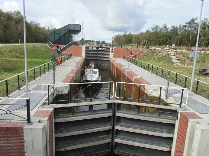
Spaarsluis is another new lock, and has two side pounds in operation. These save a lot of water, when the lock is emptied, as half the water goes into these. This can then be used, next time the lock is filled up.
We moored below Oranjesluis, with two other boats. Oranjesluis is operated by remote control, possibly from Spaarsluis. As we approached the lock the lights went red and green, to say " I know you are there". The lock gates then opened for us and we were worked through, but not a person in sight. it is obviously very efficient, but still seems weird!
Subscribe to:
Posts (Atom)